Design network layouts directly on an interactive map
Draw, place, and connect network objects with point-and-click precision — all from your browser, no desktop installs required.
Feature breakdown
How this capability works inside the platform.
Each section below focuses on a distinct workflow or system behavior so teams can quickly see how the feature fits into real operational planning.
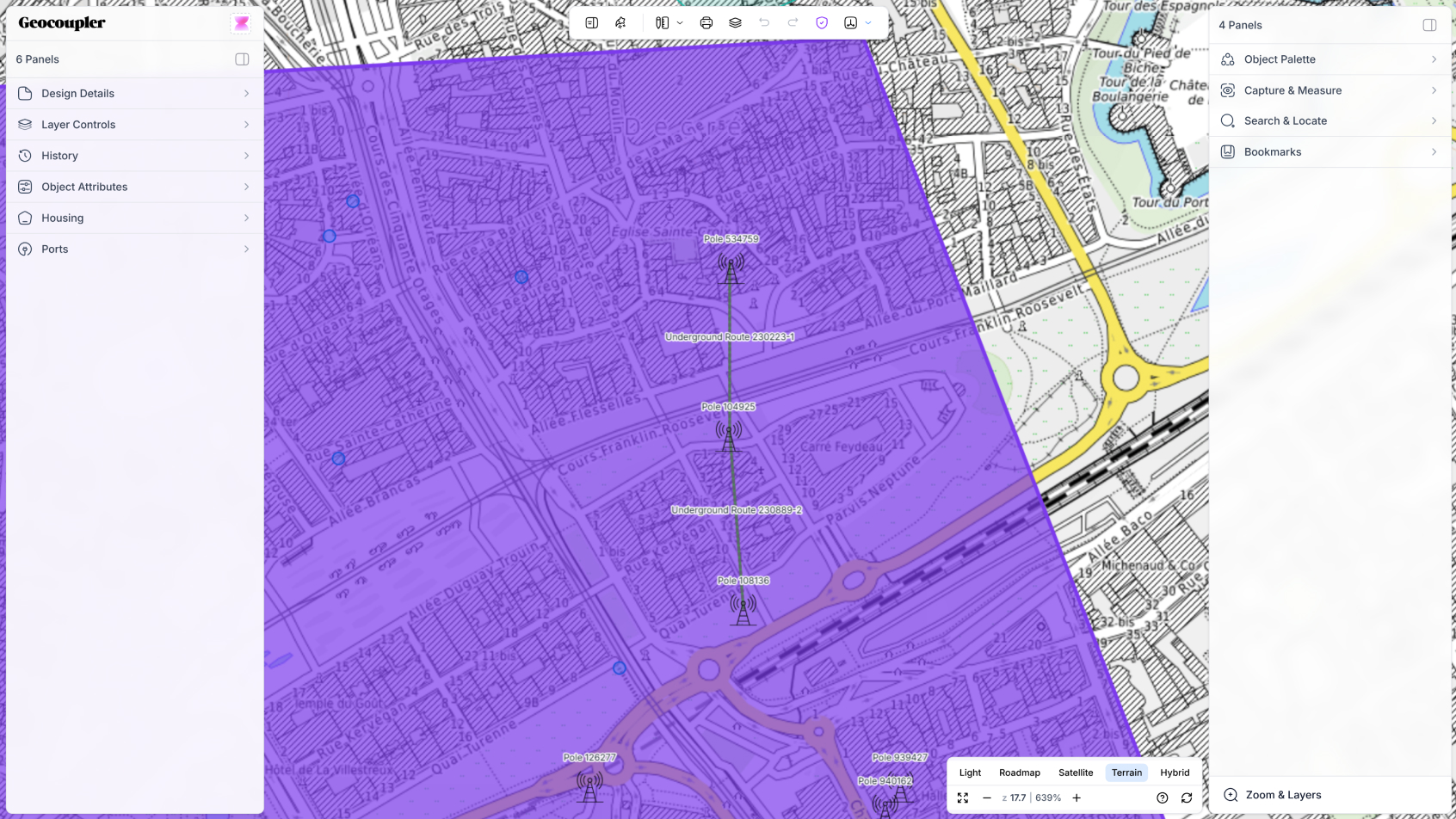
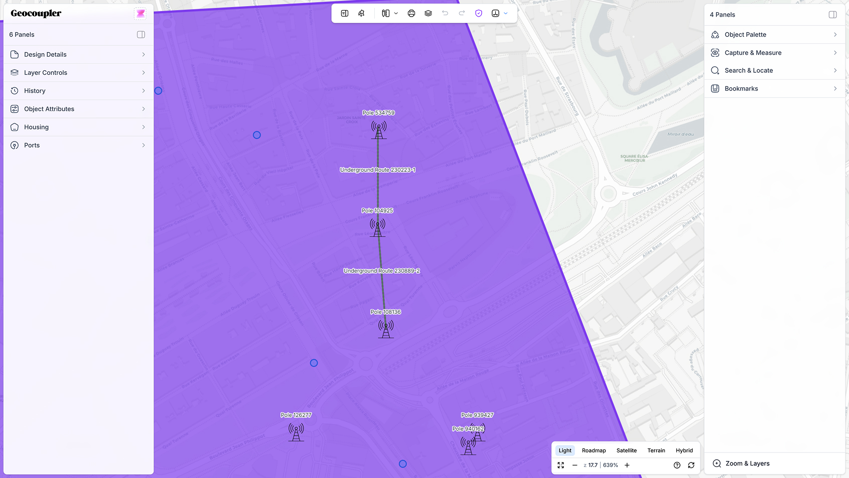
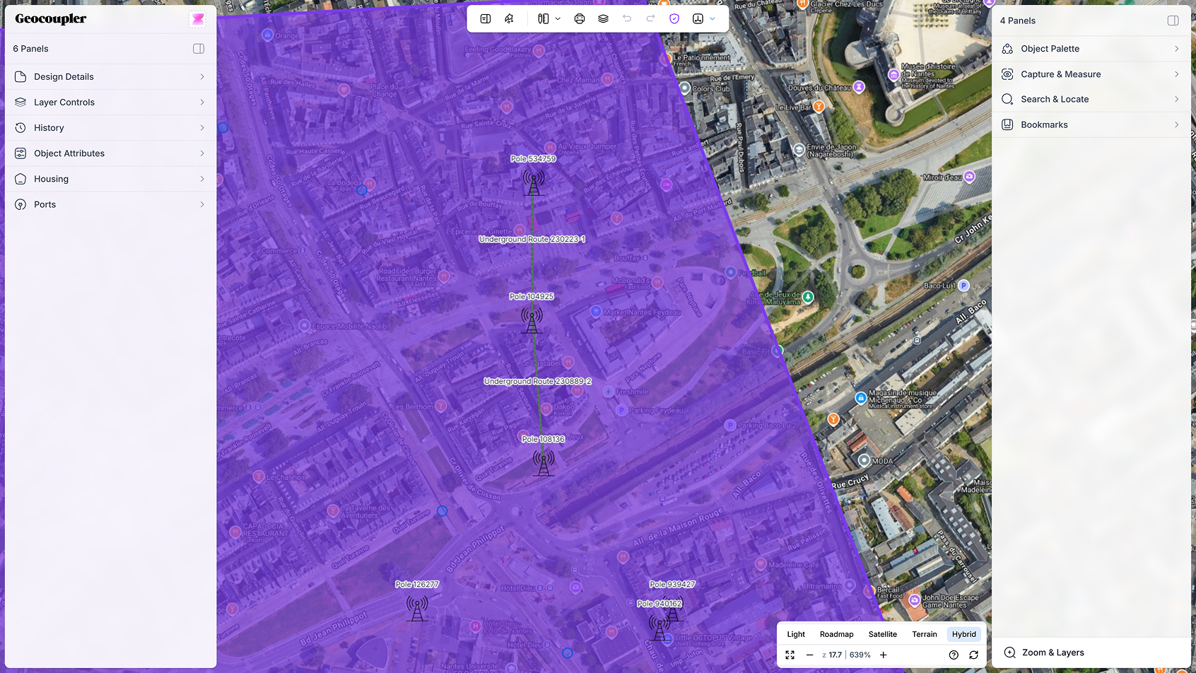
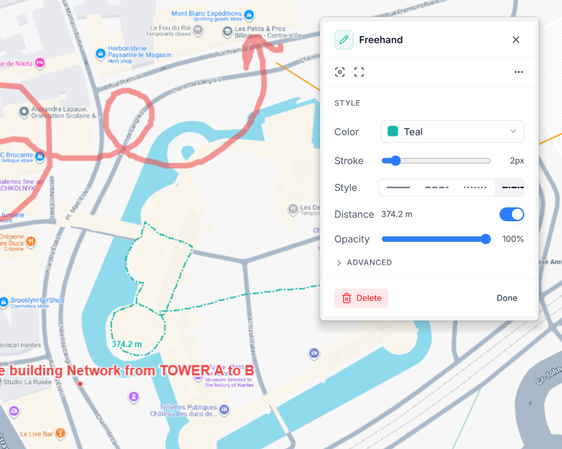
ANNOTATION TOOLS
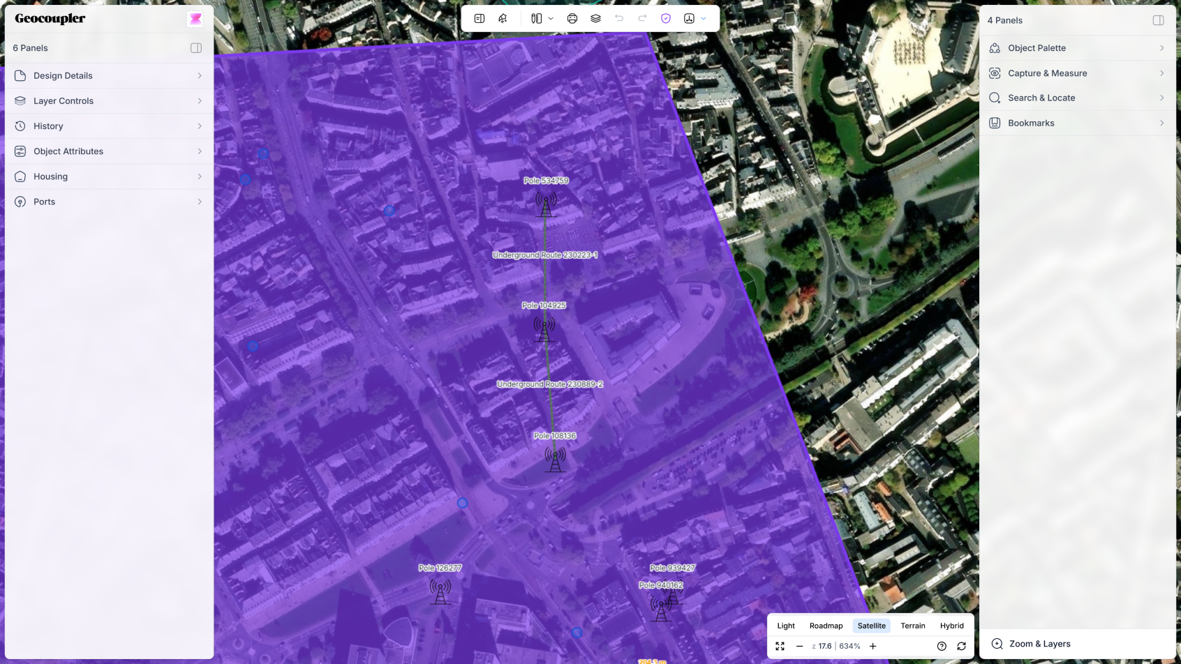
Place objects with sub-meter accuracy
Every node, path, and object snaps to real-world coordinates. The map editor supports multiple basemap layers, coordinate reference systems, and precision placement with auto-snap to existing network geometry.
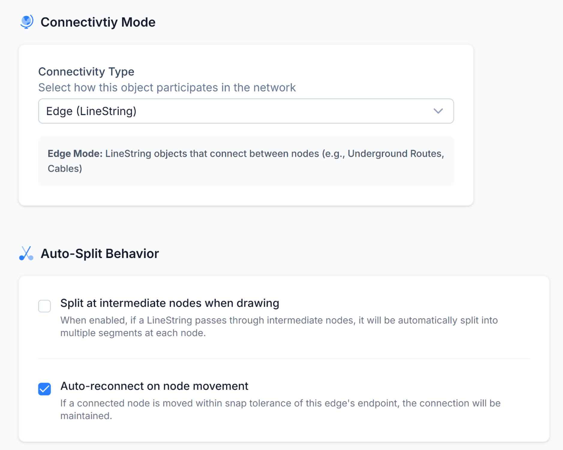
TOPOLOGY ENGINE
Setup the rules, we'll handle the geometry
When paths cross, Geocoupler automatically detects intersections within a configurable tolerance (default 0.5m), creates nodes at crossing points, and splits paths while preserving all metadata and relationships.
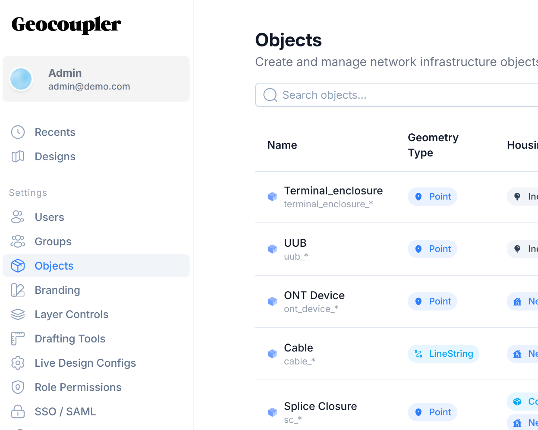
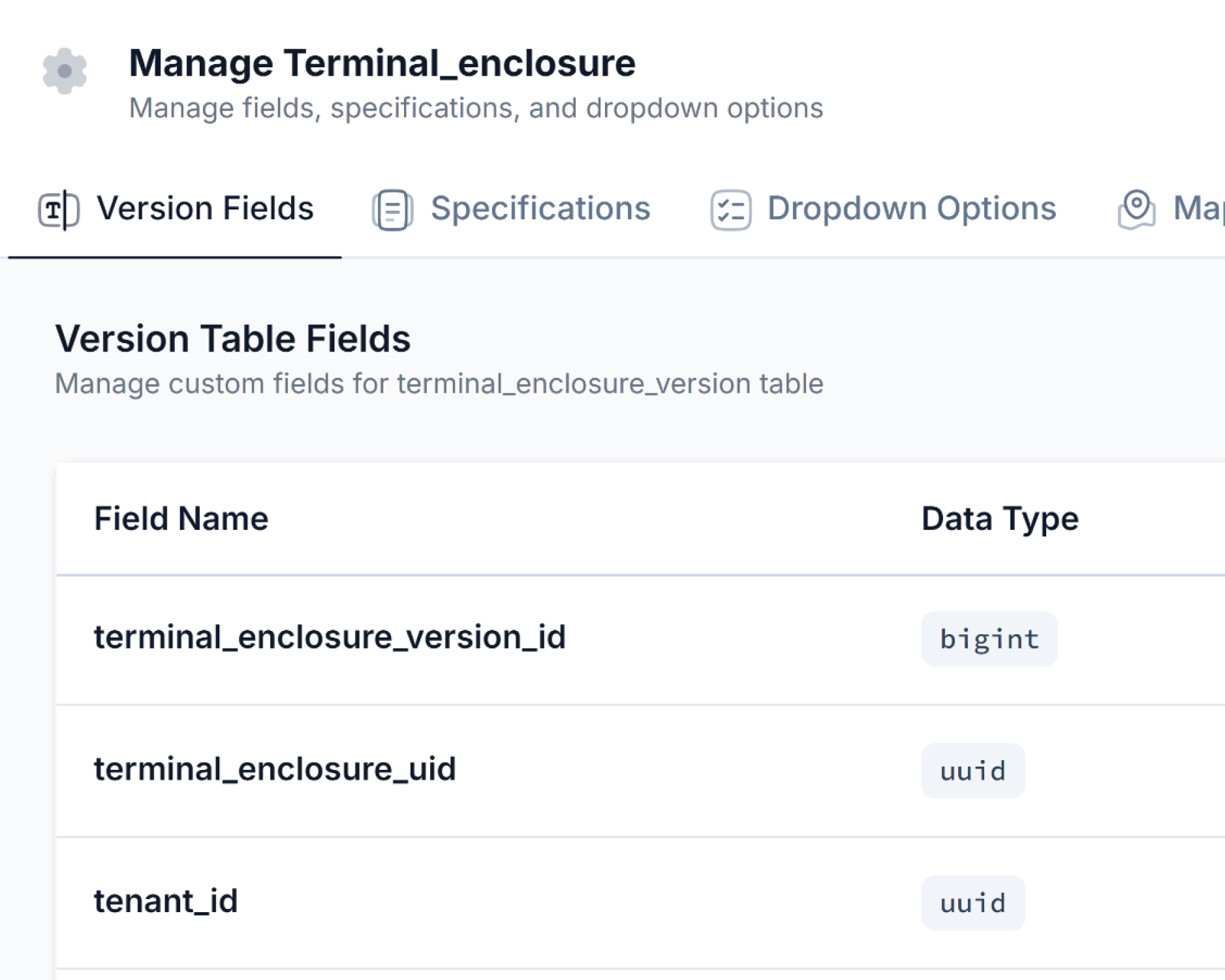
DYNAMIC OBJECTS
Define your own object types with custom attributes
No rigid schemas. Create nodes, paths, and custom objects with whatever attributes your workflow requires. Add fields, change types, and evolve your data model without migrations or downtime.
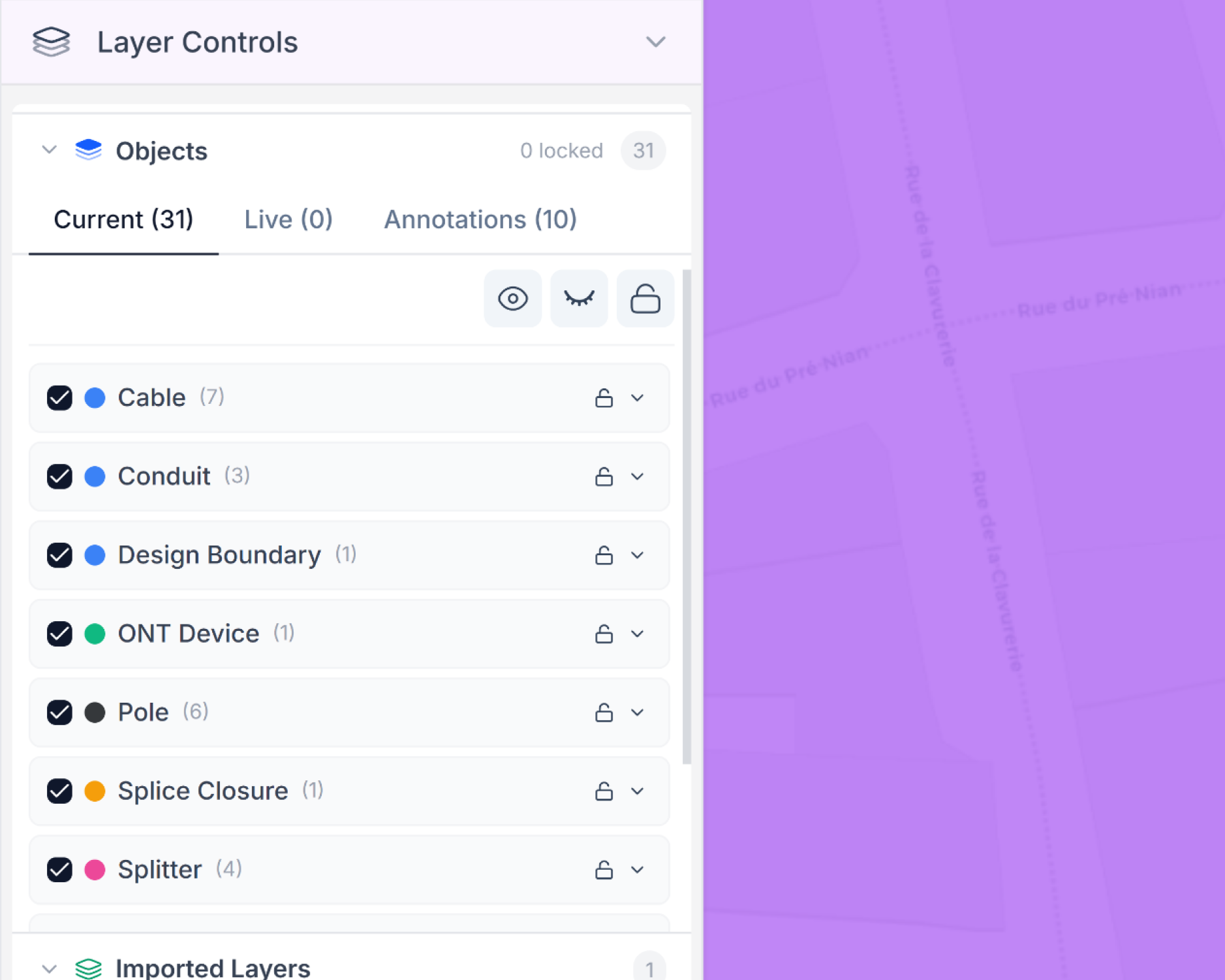
LAYER MANAGEMENT
Organize complex networks into logical layers
Group objects into layers for different network tiers, construction phases, or design variants. Toggle visibility, lock layers for editing, and control permissions at the layer level.
More features
Explore the rest of the platform.
Geocoupler works best as a connected system. Move across map editing, versioning, collaboration, security, and insights without breaking workflow context.
Ready to evaluate?
Learn how your business can benefit from a faster & easier GIS platform
Connect your data sources and see how this feature fits into the rest of your planning stack.