Spatial superpowers,
made surprisingly easy
made surprisingly easy
Geocoupler is an industry-agnostic platform for network planning and optimization
Network Topology Change Alert
On Wednesday, February 19, 2026, a topology change in the Melbourne-CBD design branch modified 23 paths and 8 nodes, exceeding the threshold of 15 objects.
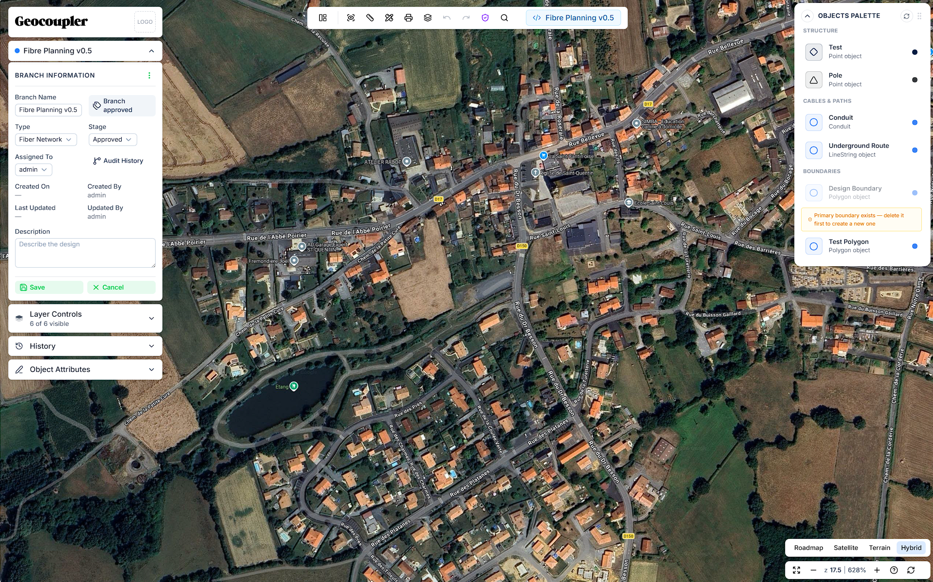
Dynamic Objects - always versioned.
Create and manage your own dynamic objects, with no requirement to fit into rigid predefined schemas. Define custom attributes, relationships, and behaviors that adapt to your unique network data and workflows.
Design faster on the web
Geocoupler's browser-based map editor lets you design network layouts with point-and-click precision — no desktop installs or legacy plugins required.
Collaborate seamlessly
Git-like branching and versioning gives every team member their own workspace — merge changes confidently without overwriting each other's work.
Scale confidently
Geocoupler enables infrastructure teams to focus on planning instead of wrestling with slow tools, manual exports, and fragmented data sources.
Geocoupler is an industry-agnostic platform for network planning and optimization
Design faster on the web
Geocoupler's browser-based map editor lets you design network layouts with point-and-click precision — no desktop installs or legacy plugins required.
Collaborate seamlessly
Git-like branching and versioning gives every team member their own workspace — merge changes confidently without overwriting each other's work.
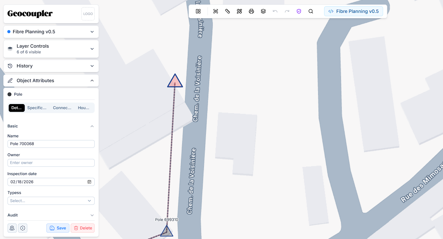
Design network layouts directly on the map
Geocoupler's browser-based map editor lets you draw, place, and connect network objects with point-and-click precision — no desktop installs required.
Distribution Hub
Trunk Route A
fiber_backbone
splice_closure_v2
Track every change with Git-like version control
Geocoupler intelligently tracks all design changes, so you can branch, commit, and merge network plans with full audit trails and rollback capability.
feat/new-zone
Add splice points
main ← staging
change_history
Coordinate across teams in real time
Geocoupler gives every team member their own workspace with role-based permissions, so teams can collaborate on shared network plans without overwriting each other's work.
Melbourne-CBD
Design Engineer
Zone B Expansion
Project Lakeside
You own your data, we keep it secure.
All traffic is encrypted via TLS, user credentials are stored with encryption at rest, all data is stored in the U.S., and we monitor DDoS activity and uptime 24/7.
Your data stays yours.. Every map has clear permission controls. Choose who sees maps and when. Enforce SSO as another layer of access management.
SOC 2 is the gold standard for security practices. Geocoupler has obtained SOC 2 Type 2 compliance and is under observation for type 2.
Get up and running in less than 15 minutes
Connect your data sources and instantly understand your network planning potential.